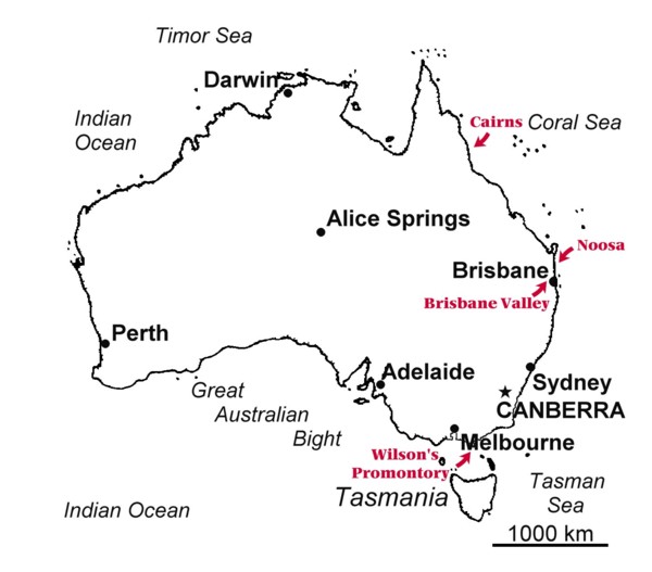
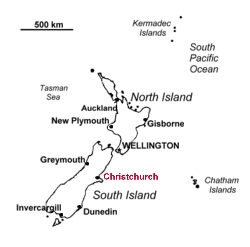
The maps, below, show the locations which are used or mentioned in the story. I have resized them to be in the same scale, which make New Zealand rather small, but I thought it gave a better idea of the geography. 1000 km is roughly 630 miles.
Australian Locations:
New Zealand Location:
Noosa
The northern-most beach on the Sunshine Coast, north of Brisbane. The best site I found for it was Noosa Net. Listed under "To Do" is a topic called "Beaches," which has a couple of photos on it. The one on the right has Noosa National Park in the foreground and Sunshine and Peregian Beaches disappearing into the distance. Peregian Beach is (from memory) 12 km south of Noosa (about 7 or 8 miles).
Scroll up to see it on the map of Australia.
Brisbane Valley
Esk is the centre of local government for the Brisbane Valley, which is less than an hour's drive inland of Brisbane. Brisbane Valley Tourism has some more information on the region.
Scroll up to see it on the map of Australia.
Wilson's Promontory
I had a great deal of difficulty in finding anything much on the net for this location, so I haven’t provided a link. The best I could do for it is post a couple of pictures that my husband and I took there in September of 1996. The first shot was taken from a headland (whose name I don’t know). I remember that I was standing on a beach when I took the second shot (of which beach I have no idea!) and looking out to sea. Believe it or not, the two shots were taken only a short time apart, though looking in slightly different directions.
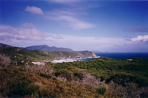
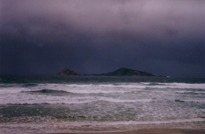
Scroll up to see it on the map of Australia.
Christchurch
The site that I had linked for pictures and information on Christchurch seems to have disappeared off the net. It’s a beautiful region, though, and you should be able to find plenty of pictures if you care to Google them.
Scroll up to see it on the map of New Zealand.
Lattice Slice
3 teaspoons gelatine
1/2 cup boiling water
250g cream cheese
250g unsalted butter
1 cup castor sugar
1/2 teaspoon vanilla & drop of lemon essence or juice
2 packets Arnott's Lattice biscuits
Dissolve gelatine in boiling water. Set aside and allow to cool. Cream together cream cheese, unsalted butter, sugar, vanilla and essence. Beat in gelatine. Use lattice biscuits to line lamington tin, one packet for bottom layer, second for top layer. Fill with cream cheese mixture and chill.
All measurements are metric. One metric teaspoon is 5 ml (I think that's the same as an American teaspoon). One metric cup is 250 ml (I think that's rather more than an American cup). Castor sugar is the one with the smallest crystals. "Biscuit" in Australia is equivalent to "cookie" in the U.S.
Back to The Long Way Home Page
The maps on this page are from an old graphics CD I have and don't appear to have a copyright. I have altered them to suit the purpose of this page. All other images are mine.